


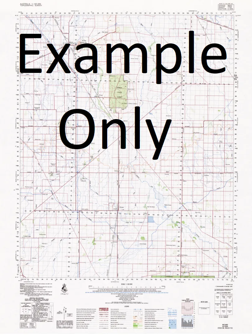
This Topographic Map is produced by Geoscience Australia; Australia's national geospatial organisation.
GA topographic maps (many of which are produced in partnership with the Army) are generally older than those maps produced by the State Governments over the same area. This makes GA maps particularly useful for identifying historic features, such as old mines and diggings.
Geoscience Australia maps generally considered to be more pleasing in design and compilation then the more modern State Government productions.
At this scale, 1cm on this map represents 1km on the ground. A standard map (which is square) covers an area of approximately 54km by 54km, with a contour interval of 20m. This map contains natural and constructed features including road and rail infrastructure, vegetation, hydrography, contours, localities and some administrative boundaries.
Please note the date of the map, as this will impact the currency of information, particularly regarding infrastructure, roads, etc.
Karalee Tara The Laurels Brooklands Glen Cairn Glenara Glenview Woodlands Sunny Dale Floradale Lorraine Janiemont Claremont Serada Graystones Kilburnie Kendalee Springvale Holicombe Maxwood Park Medley Farm Burnside New Park Nanbubulla Wanbanalong The Caveat Rothleigh Ramford Ranch Wappan Reedy Creek Berghol Mittagong Banoon Leobarden Nar-Darak Sandford Flora Vale Spring Creek Graceburn Park Mount Valley View Kevian Park Bonnie Brae Fairview Park Cotswoods Lake Heights Amberfield Glen Doone Langwell Cremona Park Whanregarwan Nutfield Taldra Dovercourt Athone Park Glen Keith Silver Springs Mill Brook Mount Pleasant The Oaks Farm Coolongolook Red Gate The Rennie Hughendon Attunga Avalon Bravick Willawong Heatherly Stonelea Kejude Mount Eyrie The Orb Blondell Park Hatfield Park Craggan Lindisfarne Gooramadda Hillstone Manor Ramleigh Park Carwoola Tarcoola Hillside Glen Craig Darrowby Ambleton Brookfield Benwerrin Marook Bralynn Misty Hills Glendale Farm Roslyn Rivendell Clearstream Glenmore Park Curragundi Paringa Burrowye Cathedral Downs Romsey Vale Merindah Glendale Park Acheron Downs Greenacres Kilfinin Blue Hills Yungella Kenloydon Robinvale Acheron Park Cathlane Nareen Tyrone Gunyah Park Buxton Park Boronia Maryton Sambar Lodge Alexandra Eildon Acheron Acheron Primary School Acheron Ridge Acheron River Aird Inlet Alexandra Hospital Alexandra Magistrates Court Alexandra Police Station Alexandra Primary School Alexandra Recreation Reserve Alexandra Secondary College Anderson Harbour Andrew Spur Andrews Creek Andrews Spur Anglesey Arthur Range Beeag Creek Auriferous Spur Balaclava Creek Bald Hill Banyarmbite Barbras Gully Barker Gully Barker Ridge Barnewall Gully Barnewall Inlet Barnewall Plains Batchelors Creek Battery Gully Bedrock Creek Beech Creek Big Hill Bill Head Black Range Black Range State Forest Blackwood Camping Area Blackwood Flat Bleak Hill Blowhard Spur Blue Gum Creek Blue Gum Flat Hump Saddle The Blue Range Bob Cecil Creek Bolte Bay Bonnie Doon Bonnie Doon Primary School Boroodara Walking Track Boundary Hut Bowens Gully Brankeet Brankeet Inlet Break O'Day Range Briar Cove Brooks River Reserve Brown Creek Bryant Creek Bryant Inlet Bull Creek Bull Creek Camping Area Bull Creek Picnic Area Bullock Gully Buttress Pinnacles Buxton Buxton Caves Buxton Peak Buxton Primary School Buxton Spur Buxton Spur Walking Track Cabbage Tree Gap Camel Farm and Zoo Cameron Creek Cameron Point Camp Creek Camp Westlake Candle Bark Creek Candlebark Nature Gully Walk Canyon Walking Track Cathedral North Cathedral Peak Walking Track Cathedral Range Cathedral Range Park Cathedral Range State Park Cathkin Cathkin Reserve Cathy Creek Cedar Lodge Cerberean Ranges Cerberus Creek Chapel Hill Chinaman Hill Christie Hill Chrystal Creek Claire Saddle Cold Weather Hill Coller Bay Coller Creek Conn Gap Conn Hill Niagaroon Creek Conundrum Cook Point Cooknells Gully Cooks Mill Coopers Point Corduroy Creek Corduroy Creek North Branch Corduroy Creek South Branch Crockett Bay Crockett Island Crooked Creek Crystal Creek Cumberland Creek Cure Spur Dead Sheep Creek Dead Timber Hill Deep Creek Delatite Arm Delatite Plantation Devass Gully Devil Cove Devils River Dip Creek Doak Point Doctor Gully Doolam Swamp Creek Dropmore Dry Creek Dry Creek Gap Dry Creek Hill Dudley Creek Dudley Saddle Dumbells Dutch Joe Creek Dyke Creek Easts Lookout Echo Flat Edwards Creek Egans Bridge Eildon Community Hospital Eildon Lions Leisure Park Eildon Park Eildon Police Station Eildon Primary School Eildon State Park Elliot Creek Enigma Hill Trig Estate Spur Ewarts Flat Fairey-Wright Inlet Falls Creek Falls Creek Picnic Area Federation Range Ferns Camping Area Ferny Creek Finger Buttress Fish Creek Flea Creek Pinniger No. 2 Trig Foggs Lookout Ford Inlet Fraser National Park Friday Creek Futurefish Eildon Fishing Trails Galvin Bay Geelong Hill Gerraty Bay Ghost Point Gin Case Creek Glen Inlet Glendale Gobur Gobur Recreation Reserve Godfreys Creek Gordon Creek Granite Range Green Hill Creek Gullitons Flat Haines Saddle Halls Flat Hargrave Creek Hargrave Spur Harrops Flat Harrops Hills Health Creek Henkes Winery Hermit Creek Higginbotham Mine High Camp Highett Point Historic Pindi Mill Site Picnic Area Pound Gap Home Creek Home Point Honeymoon Creek Horse Bay Horse Gully Horseyard Creek Horseyard Range Howes Inlet Hughes Creek Igloo Gap Italian Gully Italian Gully Mines Jack of Clubs Spur Jawbone Creek Jawbone Creek Walking Track Jawbone Saddle Jeep Track Flat Jeep Track Gully Jerusalem Creek Jerusalem Creek Marina & Camping Ground Jerusalem Creek South Branch Jerusalem Inlet Jimmys Spur Johnson Creek Jubilee Ridge Junction Camp Kahrs Gully Kangaroo Gully Kangaroo Gully Flat Kanumbra Keg Spur Kennedy Point Keppel Creek Keppel Falls Keppel Hut Keppel Hut Creek Keppels Ridge Keppels Falls Scenic Reserve Keppler Creek King Creek Kirbys Flat Knobby Spur Knowles Gap Knowles Gap Creek Koala Gully Koriella Koriella Fire Station Kunnin Creek Lake Eildon Lake Eildon Country Club Lightfoot Gully Lightwood Bay Lightwood Inlet Limestone Creek Little Cathedral Little Cathedral Walking Trail Little River Little River Falls Little River Fire Track Little River Walking Track Little Rubicon River Little Steavenson River Long Gully Lowerson Walking Track Lubra Dam Maclennans Gully Magazine Gully Maindample Maintongoon Maintongoon Inlet Mallet Creek Martur Falls Marysville View Maughan Point McClure Creek McDiarmed Bay McDonald Island McKenzie Flora Reserve Merton Merton Creek Merton Gap Middle Creek Middle Range Middle Spur Mill Creek Mine Spur Mitchell Bay Mohican Mohican Plantation Molesworth Molesworth Telephone Exchange Morris Lookout Morris Picnic Area Mossy Creek Mount Bullfight Mount Cathedral Park Lodge Mount Concord Mount Cunningham Mount Despair Mount Enterprise Mount Klondyke Mount Margaret Mount Margaret Gap Mount Margaret Quarry Mount Maxwell Mount Mitchell Mount Nibo Mount Paradox Mount Pinniger Mount Pinninger Mount Prospect Mount Sugarloaf View Mount Torbreck Mountain Run Walking Track Mountaineer Creek Mountaineer Inlet Mrs Bon Bay Murrindindi Murrindindi Falls Picnic Area Murrindindi River Murrindindi River Walking Track Murrindindi Scenic Reserve Murrindindi School Camp Murrindindi Shire Myles Bridge Myrtle Loop Mystery Creek Native Dog Gap Neds Gully Neds Gully Walking Track Neds Peak Neds Saddle Neely Point Newman Creek Newman Plain Niagaroon Nichol Inlet Nicholas Hill Nicholas Inlet No Man Creek North Buxton Peak North Jawbone Peak Norton Gully O K Mine O'Toole Creek O'Toole Flat Orchid Creek Owens Hill Palmer Creek Panorama Hill Panorama Track Paps Bay Paps Scenic Reserve Parker Point Parkers Flat Parkers Pines Parkers Point Parsons Point Peak Spur Pedersen Gully Peppin Point Perfect Beggar Spur Perfect Cure Creek Phantom Falls Picnic Point Pine Tree Camping Area Pinninger Point Point Brose Point Dethridge Point Hanslow Point Hill Point Kernot Point Mason Point McCay Point Mead Point Mibus Point Robertson Point Shaw Point Speedie Point Swanson Point Tehan Point Worner Porcupine Creek Preston Point Proctor Pulfords Bridge Puzzle Range Pyramid Hill Quartz Creek Raids Inlet Rantin Robin Rocks Razorback Ridge Walking Track Red Hill Redfern Point Rennie Inlet Riversdale Bridge Robb Hill Robbie Creek Robinson Mill Robinsons Mill Site Rocky Mouth Spur Rocky Spur Rough Hill Royston Dam Royston Falls Royston Gap Royston Range Royston River Rubicon A Switching Station Rubicon Bridge Rubicon Dam Rubicon Falls Rubicon Falls Power Station Rubicon Lower Power Station Rubicon School Camp Rubicon Power Station Rubicon River Rubicon State Forest Running Creek S Creek Salvage Creek Sanders Point Sandstone Creek Sawers Bay Sawpit Gully School Point Scrubby Creek Sea Elephant Rock Second Creek Sheep Dip Sheep Dip Creek Sheepwash Lagoon Sheoak Creek Sheoak Spur Snap Creek Snobs Creek Snobs Creek Falls Snobs Gap Solferimo Mine South Jawbone Peak South Jawbone Walking Track Spade Cove Spion Kopje Spring Bay Stanley Homestead Picnic Area Station Creek Stevenson River Steeles Creek Stillman Plateau Stillmans Lookout Stillmans Point Stirling Creek Stockyard Bay Stockyard Creek Stone Bay Stony Creek Storm Creek Stringybark Range Sugarloaf Sugarloaf Hut Sugarloaf Peak Sugarloaf Saddle Survey Peak Suspension Bridge Suspension Bridge Camping Area Taggerty Taggerty Pioneer Settlement Taggerty Primary School Taggerty River Taggerty River Crossing Picnic Ground Take Off Creek Tallangalook Creek Tarrawarra Camping Area Taylor Bay Taylors Teal Bay Ten Fathom Ridge Terip Terip Fire Station Terip Terip Primary School The Basin The Beeches Picnic Ground The Beeches Walking Track The Buttress The Cathedral The Farm The Farmyard The Gorge The Green Hill The Island The Music Bowl The Paps The Park The Pines The Pinnacle The Razorback Thornton Thornton Airfield Thornton Primary School Three Sisters Tin Creek Tin Dish Creek Tin Shed Gully Tom Burns Creek Toolangi State Forest Torbreck Torbreck Range Torbreck River North Branch Torbreck River South Branch Tower Spur Tratford Historic Mill Site Tungamah Public Hall Tweed Spur U T Creek United Kingdom Gap Valuation Piont Vic Oak Mill Walker Hill Wallaby Bay Water Guage Camping Area Waterson Point Weir Creek Wells Cave Wells Cave Walking Track Wentworths Flat Wet Creek Wet Plain Creek Whanregarwan Fire Station Whanregarwen Whisky Creek White Cow Gap White Creek Whitehorse Gully Whitehouse Creek Whitehouse Creek Scenic Reserve Whitehouse Saddle Wightman Hill Wild Oats Hill Wilhelmina Falls Williams Creek Wilson Creek Wilson Inlet Winch Hill Wood Gulch Woodbridge Point Woodfield Woolshed Creek Woolshed Inlet Woolshed Island Xylophone Bridge Yanks Folly Yarck Yarck Primary School Yarck Telephone Exchange Yea Rock Yellow Creek Yellowdindi Creek Terip Terip Strathbogie Range Gerar Creek Fords Creek Fawcett Colonial Creek Howes Creek Delatite River Eildon Reservoir Sugarloaf Reservoir Eildon Weir Limestone Jerusalem River Stevensons River Bruxton Upper Plenty


